Posts

Showing posts with the label Natural UNESCO Heritage Sites

Sichuan Giant Panda Sanctuaries

Image
Sichuan Giant Panda Sanctuaries - Wolong, Mt Siguniang and Jiajin Mountains is principally renowned for its importance for the conservation of the giant panda, recognized as a "National Treasure" in China and as a flagship for global conservation efforts. The property is the largest and most significant remaining contiguous area of panda habitat in China and thus the world. It is also the most important source of giant panda for establishing the captive breeding population of the species. Continent: Asia Country: India Category: Natural Criterion: (X) Date of Inscription: 2006

Three Parallel Rivers of Yunnan Protected Areas

Image
Three Parallel Rivers of Yunnan Protected Areas is situated in south-west China. The site consists of 15 protected areas (in eight geographical clusters) in the mountainous north-west of Yunnan Province. Continent: Asia Country: China Category: Natural Criterion: (VII)(VIII) (IX) (X) Date of Inscription: 2010

Mount Sanqingshan Granite Peaks and Granite Pillars

Image
Mount Sanqingshan National Park, a 22,950 ha property located in the west of the Huyaiyu mountain range in the northeast of Jiangxi Province (in the east of central China) has been inscribed for its exceptional scenic quality, marked by the concentration of fantastically shaped pillars and peaks: 48 granite peaks and 89 granite pillars, many of which resemble human or animal silhouettes. Continent: Asia Country: China Category: Natural Criterion: (VII) Date of Inscription: 2008

The South China Karst Landscapes

Image
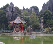
The South China Karst region extends over a surface of half a million km2 lying mainly in Yunnan, Guizhou and Guangxi provinces. It represents one of the world’s most spectacular examples of humid tropical to subtropical karst landscapes. The stone forests of Shilin are considered superlative natural phenomena and a world reference with a wider range of pinnacle shapes than other karst landscapes with pinnacles, and a higher diversity of shapes and changing colours. The cone and tower karsts of Libo, also considered the world reference site for these types of karst, form a distinctive and beautiful landscape. Wulong Karst has been inscribed for its giant dolines (sinkholes), natural bridges and caves. Continent: Asia Country: China Category: Natural Criterion: (VII)(VIII) Date of Inscription: 2007

The Pitons Management Area Volcanic System

Image
The Pitons Management Area contains the greater part of a collapsed stratovolcano contained within the volcanic system, known to geologists as the Soufriere Volcanic Centre. Prominent within the volcanic landscape are two eroded remnants of lava domes, Gros Piton and Petit Piton. Continent: North America Country: Saint Lucia Category: Natural Criterion: (VII)(VIII) Date of Inscription: 2004

Wulingyuan Scenic Historic Interest Area China

Image
A spectacular Wulingyuan Scenic Historic Interest Area in China stretching over more than 26,000 ha in China's Hunan Province, the site is dominated by more than 3,000 narrow sandstone pillars and peaks, many over 200 m high. Between the peaks lie ravines and gorges with streams, pools and waterfalls, some 40 caves, and two large natural bridges. In addition to the striking beauty of the landscape, the region is also noted for the fact that it is home to a number of endangered plant and animal species. Continent: Asia Country: China Category: Natural Criterion: (VII) Date of Inscription: 1992

Huanglong Scenic Historic Interest Area China

Image
Huanglong Scenic Historic Interest Area in China is situated in the north-west of Sichaun Province; the Huanglong valley is made up of snow-capped peaks and the easternmost of all the Chinese glaciers. In addition to its mountain landscape, diverse forest ecosystems can be found, as well as spectacular limestone formations, waterfalls and hot springs. The area also has a population of endangered animals, including the giant panda and the Sichuan golden snub-nosed monkey. The property lies in the southern part of the Min Shan Range, approximately 150 km north/north-west of the provincial capital of Chengdu. It is divided into two distinct sites: the Huanglong subdivision and the Mouni Gully subdivision. Continent: Asia Country: China Category: Natural Criterion: (VII) Date of Inscription: 1992

Manas Wildlife Sanctuary Assam

Image
Manas takes its name from the Goddess Manasa. The Manas Wildlife Sanctuary is noted for its spectacular scenery, with a variety of habitat types that support a diverse fauna, making it the richest of all Indian wildlife areas. The park represents the core of an extensive tiger reserve that protects an important migratory wildlife resource along the West Bengal to Arunachal Pradesh and Bhutan borders. Its wetlands are of international importance. It is also the single most important site for the survival of pygmy hog, hispid hare and golden langur. Continent: Asia Country: India Category: Natural Criterion: (VII)(IX) (X) Date of Inscription: 1985 Manas Reserve Forest The park, which includes part of Manas Reserve Forest and all of North Kamrup Reserve Forest, constitutes the core of Manas Tiger Reserve located in the forest divisions of Kachugaon, Haltugaon, Western Assam Wildlife and North Kamrup. Lying in the foothills of the Outer Himalaya, the area is low-l...

Keoladeo National Park Rajasthan

Image
Keoladeo National Park is situated in eastern Rajasthan, the park is 2 km south-east of Bharatpur and 50 km west of Agra. The area consists of a flat patchwork of marshes in the Gangetic plain, artificially created in the 1850s and maintained ever since by a system of canals, sluices and dykes. Normally, water is fed into the marshes twice a year from inundations of the Gambira and Banganga rivers, which are impounded on arable land by means of an artificial dam called Ajan Bund, to the south of the park. The first time, usually in mid-July, is soon after the onset of the monsoon and the second time is in late September or October when Ajan Bund is drained ready for cultivation in winter. Continent: Asia Country: India Category: Natural Criterion: (X) Date of Inscription: 1985 Keoladeo Monsoon Thus, the area is flooded to a depth of 1-2 m throughout the monsoon (July-September), after which the water level drops. From February onwards the land begins to dry ou...

Kaziranga National Park India

Image
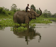
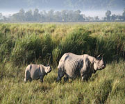
In the heart of Assam, Kaziranga National Park is one of the last areas in eastern India undisturbed by a human presence. It is inhabited by the world's largest population of one-horned rhinoceroses, as well as many mammals, including tigers, elephants, panthers and bears, and thousands of birds. In the heart of Assam, this park is one of the last areas in eastern India undisturbed by a human presence. It is inhabited by the world's largest population of one-horned rhinoceroses, as well as many mammals, including tigers, elephants, panthers and bears, and thousands of birds. Continent: Asia Country: India Category: Natural Criterion: (II)(IV) Date of Inscription: 2011 The Water Coverage of Kaziranga The site is on the southern bank of the Brahmaputra River at the foot of the Mikir Hills. The park lies in the flood plains of the Brahmaputra. The riverine habitat consists primarily of tall, dense grasslands interspersed with open forests, interconnecting...

Noel Kempff Mercado National Park Bolivia

Image
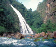
The Kempff Mercado National Park is one of the largest (1,523,000 ha) and most intact parks in the Amazon Basin. With an altitudinal range of 200 m to about 1,000 m, it contains a rich mosaic of habitat types from cerrado savannah and forest to upland evergreen Amazonian forests. The park boasts an evolutionary history dating back over a billion years to the Precambrian. Located on the border with Brazil, the site includes a large section of the Huanchaca Plateau and surrounding lowlands. There are rugged cliffs in the northern, western and southern sides of the plateau, with several valleys and steep slopes in its eastern side. Several rivers have their sources on the plateau and form spectacular waterfalls. The largest river in the area is the Iténez, which marks the border with Brazil, to the north of the park, and the Paraguá River dominates the lowlands to the west. Continent: South America Country: Bolivia Category: Natural Criterion: (IX)(X) Date of Inscription: ...

Pirin National Park Bulgaria

Image
Pirin National Park is extending over an area of 27,400 ha and lying at an altitude of 1,008-2,914 m in the Pirin Mountains, south-west Bulgaria, Pirin National Park has a limestone Balkan landscape, with lakes, waterfalls, caves and pine forests. The rugged mountains, with some 70 glacial lakes scattered throughout them, are home to hundreds of endemic and rare species, many of which are representative of the Balkan Pleistocene flora. The mountains also have diverse and unique landscapes of great aesthetic value. Continent: Europe Country: Bulgaria Category: Natural Criterion: (VII)(VIII) (IX) Date of Inscription: 1983

Srebarna Nature Reserve Bulgaria

Image
The Srebarna Nature Reserve is a freshwater lake adjacent to the Danube and extending over 600 ha. It is the breeding ground of almost 100 species of bird, many of which are rare or endangered. Some 80 other bird species migrate and seek refuge there every winter. Among the most interesting bird species are the Dalmatian pelican, great egret, night heron, purple heron, glossy ibis and white spoonbill, white-tailed eagle, little cormorant. Continent: Europe Country: Bulgaria Category: Natural Criterion: (X) Date of Inscription: 1983

Durmitor National Park Montenegro

Image
Durmitor National Park comprises Mount Durmitor plateau and the valley formed by the canyon of the River Tara, incorporating three major geomorphologic features: canyons, mountains and plateaux. Because of its geographical location and range in altitude, the park is under the influence of both Mediterranean and alpine microclimates, which has resulted in an exceptional range of species. Continent: Europe Country: Montenegro Category: Natural Criterion: (VII)(VIII) (X) Date of Inscription: 1980

World Heritage Te Wahipounamu

Image
Te Wahipounamu comprises the least-disturbed tenth of New Zealand's land mass, with some 2 million hectares of temperate rainforest, 450 km of alpine communities, and a distinctive fauna. It contains the best modern representation of the ancient flora and fauna of Gondwanaland, including Podocarpus species, genera of beech, flightless kiwis, 'bush' moas and carnivorous Powelliphanta land snails. The overwhelming mountainous character of the area results from tectonic movement between the Pacific plate and the Indo-Australian plate over the last 5 million years. High local relief is the result of deep glacial excavation. Continent: Oceania Country: New Zealand Category: Natural Criterion: (VII)(VIII) (IX) (X) Date of Inscription: 1990

Thailand Thungyai-Huai Kha Khaeng Wildlife Sanctuaries

Image
The Thungyai-Huai Kha Khaeng Wildlife Sanctuaries comprises two contiguous wildlife sanctuaries: Thung Yai and Huai Kha Khaeng, alongside the western international border with Myanmar, 300 km north-west of Bangkok. The terrain in Huai Kha Khaeng is generally hilly with many permanent and seasonal streams. The highest peak lies in the extreme north of the sanctuary. Valleys are interspersed with small lowland plains. In Thung Yai the topography is more dissected with a network of many permanent rivers and streams dividing the area onto valleys and lowland plains. A distinguishing feature is a large central grassland plain, from which the Sanctuary takes the name of Thung Yai ('big field'). Within the catchment area are four important rivers, one of which flows through Burma to the Andaman Sea. Continent: Asia Country: Thailand Category: Natural Criterion: (VII)(IX) (X) Date of Inscription: 1991

West Norwegian Fjords Norway

Image
Situated in south-western Norway, north-east of Bergen, Geirangerfjord and Naoyfjord, set 120 km from one another, are part of the west Norwegian fjord landscape, which stretches from Stavanger in the south to Andalsnes, 500 km to the north-east. The two fjords, among the world's longest and deepest, are considered as archetypical fjord landscapes and among the most scenically outstanding anywhere. Their exceptional natural beauty is derived from their narrow and steep-sided crystalline rock walls that rise up to 1,400 m from the Norwegian Sea and extend 500 m below sea level. The sheer walls of the fjords have numerous waterfalls while free-flowing rivers cross their deciduous and coniferous forests to glacial lakes, glaciers and rugged mountains. The landscape features a range of supporting natural phenomena, both terrestrial and marine, such as submarine moraines and marine mammals. Continent: Europe Country: Norway Category: Natural Criterion: (VII)(VIII) Date o...

Sub-Antarctic Islands New Zealand

Image
The New Zealand Sub-Antarctic Islands consist of five island groups located in the Pacific sector of the Southern Ocean off the south-eastern coast of New Zealand. Along with the Macquarie Island World Heritage site in Australia, the five islands form the only subantarctic island group in the region. The islands lie between latitudes of 47º and 52º south and include the Snares, Bounty Islands, Antipodes Islands, Auckland Islands and Campbell Islands. Total land area is 76,458 ha. The site includes a marine component extending 12 km from each island group. Continent: Oceania Country: New Zealand Category: Natural Criterion: (IX)(X) Date of Inscription: 1997

World Heritage W National Park of Niger

Image
The part of 'W' National Park that lies in Niger is situated in a transition zone between savannah and forest lands and represents important ecosystem characteristics of the West African Woodlands/Savannah Biogeographical Province. The site reflects the interaction between natural resources and humans since Neolithic times and illustrates the evolution of biodiversity in this zone. The 'W' National Park, so named because of the local configuration of the Niger River (220,000 ha), is located in a transition zone between Sudan and Guinea savannahs and contiguous to 'W' National Parks in both Burkina Faso and Benin, and the Reserve de Faune de Tamou to the north. Shrub savannah is the most widespread vegetation type occurring on shallow infertile soils. Continent: Africa Country: India Category: Natural Criterion: (IX)(X) Date of Inscription: 1996

Uvs Nuur Basin Russian Federation

Image
Uvs Nuur is the northernmost of the enclosed basins of Central Asia. It is enclosed on the north (Tuva) by the Tannu Ola Range and the Sangilen Mountains in the north-east. The main feeder to Uvs Nuur is the Tes-Khem River, which has its source in a fresh-water lake, Sangyn Dalai Nuur, in the alpine meadows and larch forests of the Sangilen uplands at the eastern extremity of the basin (in Mongolia). The Tes-Khem then flows 500 km westwards, through steppe and desert, into southern Tuva, and then back into Mongolia, before emptying into Uvs Nuur. For its last 100 km, the river meanders through an extensive wetland complex, a green swathe in an otherwise semi-desert landscape; its delta is some 40 km wide and is an important wildlife habitat. Continent: Asia Country: Russian Federation, Mongolia Category: Natural Criterion: (IX)(X) Date of Inscription: 2003